
Send Us Your Back To School Photos!
August 12, 2026

It’s the first day of school in Escambia County, and we want to share your photos in our annual back to school gallery.
Send us your back to school photos. Submit the photos on the back to school post on our Facebook page or on Twitter @northescambia. You can also email your photos to news@northescambia.com. Please submit your photos before 7 p.m. on Wednsday.
(Teachers, bus drivers and staff can submit their photos too!)
Please limit identifying information in the photos. Be cautious and don’t include house numbers (like may be by your door), or streets signs. Use only first names.
We’ll publish as many photos as we can in our back-to-school photo galleries on Thursday.
Pictured: A few of last year’s back to school photos. NorthEscambia.com file photos, click to enlarge.


Sunny, Hot And Humid For The First Day Of School
August 12, 2026
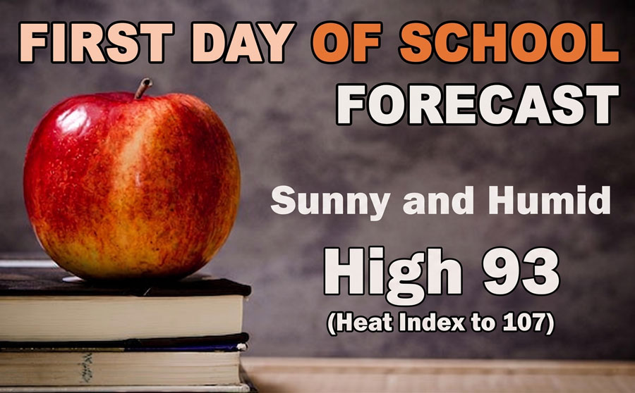
Here is your official North Escambia area back to school forecast:
Wednesday: Sunny, with a high near 93. Slight chance of an afternoon ahower. Heat index values as high as 107. West wind around 5 mph.
Wednesday Night: Mostly clear, with a low around 76. Southwest wind 5 to 10 mph.
Thursday: Sunny, with a high near 93. Heat index values as high as 107. West wind around 5 mph.
Thursday Night: Mostly clear, with a low around 76. Southwest wind around 5 mph.
Friday: Sunny, with a high near 95. West wind around 5 mph becoming calm in the morning.
Friday Night: Mostly clear, with a low around 76. Southwest wind around 5 mph becoming calm.
Saturday: A 30 percent chance of showers and thunderstorms after 1pm. Sunny, with a high near 94. Calm wind becoming northwest around 5 mph.
Saturday Night: Partly cloudy, with a low around 77. Calm wind becoming southwest around 5 mph.
Sunday: A 20 percent chance of showers and thunderstorms after 1pm. Sunny, with a high near 95.
Sunday Night: Partly cloudy, with a low around 77.
Monday: A 20 percent chance of showers and thunderstorms. Sunny, with a high near 96.
Monday Night: Mostly clear, with a low around 77.
Tuesday: A 20 percent chance of showers and thunderstorms. Sunny and hot, with a high near 97.
Wahoos Power Past Shuckers In Dominant 12-0 Win
August 12, 2026

The Pensacola Blue Wahoos began a crucial road series against the Biloxi Shuckers with a decisive win on Tuesday night, hitting three homers and allowing only four hits in a 12-0 victory.
Three key Blue Wahoos returned from the injured list, and all three made meaningful contributions. Shortstop Aiva Arquette was 2-for-3 with a homer and a walk, catcher Ryan Ignoffo was 2-for-5, and reliever Logan Whitaker worked a scoreless inning in his first game action since late May.
Blue Wahoos starter Luis Palacios allowed only a hit over 4.0 scoreless innings, and was staked to an early lead when Dylan Jasso’s RBI single in the second inning was followed by a Colby Shade three-run homer for a 4-0 edge. The Blue Wahoos tacked on two more in the third inning on a Cristian Hernández homer, and Arquette’s homer in the fourth inning extended the lead to 7-0.
In the top of the fifth, the Blue Wahoos chased Shuckers starter Jaron DeBerry (L, 7-6) with a single and a walk. Both came in to score, as Jasso lifted a bases-loaded sacrifice fly and Juan Matheus drew a bases-loaded walk against reliever Anthony Flores for a three-run inning and a 10-0 lead.
Late RBI singles from Payton Green in the seventh and Matheus in the ninth gave the Pensacola offense a dozen runs on the night.
Holt Jones (W, 3-0), Whitaker, Jaydenn Estanista and Nigel Belgrave picked up where Palacios left off, and each chipped in for a combined four-hit shutout.
With the win, the Blue Wahoos lead the second half South Division race by 3.0 games over both Columbus and Montgomery with 29 games to play in the regular season.
The Blue Wahoos continue their series against the Shuckers on Wednesday.
written by Erik Bremer
Mostly Sunny Skies Wednesday
August 11, 2026

Here is your official North Escambia area forecast:
Tuesday Night: Mostly clear, with a low around 75. Southwest wind around 5 mph becoming calm in the evening.
Wednesday: A 20 percent chance of showers and thunderstorms after 1pm. Sunny, with a high near 92. Heat index values as high as 107. Calm wind becoming southwest around 5 mph in the afternoon.
Wednesday Night: Mostly clear, with a low around 76. Southwest wind 5 to 10 mph.
Thursday: Sunny, with a high near 92. West wind around 5 mph.
Thursday Night: Mostly clear, with a low around 76. Southwest wind 5 to 10 mph.
Friday: A 20 percent chance of showers and thunderstorms after 1pm. Sunny, with a high near 94. West wind around 5 mph becoming calm in the morning.
Friday Night: Mostly clear, with a low around 76. Southwest wind around 5 mph becoming calm in the evening.
Saturday: A 30 percent chance of showers and thunderstorms after 1pm. Sunny, with a high near 93.
Saturday Night: Partly cloudy, with a low around 76.
Sunday: A 30 percent chance of showers and thunderstorms. Sunny, with a high near 94.
Sunday Night: Partly cloudy, with a low around 76.
Monday: A 30 percent chance of showers and thunderstorms. Mostly sunny, with a high near 94.
Scattered Monday Storms Give Way To Sunny, Warm Days
August 10, 2026
Isolated to scattered storms are expected through Tuesday. Heat indices around 100-107 degrees are expected through mid week, increasing late in the week.
Here is your official North Escambia area forecast:
Monday: A slight chance of showers, then a chance of showers and thunderstorms after 10am. Mostly sunny, with a high near 90. Calm wind becoming southeast around 5 mph in the afternoon. Chance of precipitation is 50%. New rainfall amounts of less than a tenth of an inch, except higher amounts possible in thunderstorms.
Monday Night: Mostly clear, with a low around 74. Southwest wind around 5 mph becoming calm in the evening.
Tuesday: A 20 percent chance of showers and thunderstorms after 1pm. Mostly sunny, with a high near 91. Calm wind becoming south around 5 mph in the afternoon.
Tuesday Night: Mostly clear, with a low around 75. Southwest wind around 5 mph becoming calm in the evening.
Wednesday: A 20 percent chance of showers and thunderstorms after 1pm. Sunny, with a high near 91. Calm wind becoming southwest around 5 mph in the morning.
Wednesday Night: Mostly clear, with a low around 76. Southwest wind 5 to 10 mph.
Thursday: Sunny, with a high near 92. West wind around 5 mph.
Thursday Night: Mostly clear, with a low around 76. Southwest wind 5 to 10 mph.
Friday: Sunny, with a high near 93.
Friday Night: Mostly clear, with a low around 75.
Saturday: A 20 percent chance of showers and thunderstorms. Sunny, with a high near 94.
Saturday Night: Mostly clear, with a low around 76.
Sunday: A 30 percent chance of showers and thunderstorms. Sunny, with a high near 94.
Scattered Showers, Hot Sunday
August 9, 2026
There is a chance of isolated to scattered showers and storm through Sunday. Otherwise, it will be mostly sunny and hot.
Here is your official North Escambia area weather forecast:
Sunday: A 40 percent chance of showers and thunderstorms, mainly after 1pm. Mostly sunny, with a high near 90. Calm wind becoming southeast around 5 mph in the afternoon.
Sunday Night: Partly cloudy, with a low around 74. South wind around 5 mph becoming calm.
Monday: A 50 percent chance of showers and thunderstorms. Mostly sunny, with a high near 90. Calm wind becoming south around 5 mph in the afternoon.
Monday Night: Partly cloudy, with a low around 74. South wind around 5 mph becoming calm.
Tuesday: A slight chance of showers, then a chance of showers and thunderstorms after 10am. Mostly sunny, with a high near 90. Calm wind becoming southwest around 5 mph in the afternoon. Chance of precipitation is 40%.
Tuesday Night: Mostly clear, with a low around 74. Southwest wind around 5 mph becoming calm in the evening.
Wednesday: A 40 percent chance of showers and thunderstorms, mainly after 1pm. Sunny, with a high near 91. Calm wind becoming southwest around 5 mph in the morning.
Wednesday Night: Mostly clear, with a low around 75. Southwest wind around 5 mph.
Thursday: A 20 percent chance of showers and thunderstorms after 1pm. Sunny, with a high near 92.
Thursday Night: Mostly clear, with a low around 75.
Friday: A 20 percent chance of showers and thunderstorms. Sunny, with a high near 93.
Friday Night: Mostly clear, with a low around 75.
Saturday: A 30 percent chance of showers and thunderstorms. Sunny, with a high near 93.
Warm Weekend, Rain More Likely On Sunday
August 8, 2026
Here is your official North Escambia area forecast:
Saturday: A 30 percent chance of showers and thunderstorms after 1pm. Sunny, with a high near 91. Calm wind becoming northeast around 5 mph.
Saturday Night: A 30 percent chance of showers and thunderstorms before 10pm. Partly cloudy, with a low around 74. Calm wind.
Sunday: Showers and thunderstorms likely between 1pm and 4pm, then showers likely and possibly a thunderstorm after 4pm. Mostly sunny, with a high near 90. Heat index values as high as 105. Calm wind becoming southeast around 5 mph in the afternoon. Chance of precipitation is 70%.
Sunday Night: A chance of thunderstorms before 7pm. Mostly clear, with a low around 74. Calm wind. Chance of precipitation is 30%.
Monday: A chance of showers, with thunderstorms also possible after 10am. Mostly sunny, with a high near 89. Calm wind becoming south around 5 mph in the afternoon. Chance of precipitation is 50%.
Monday Night: A 20 percent chance of showers and thunderstorms after 1am. Partly cloudy, with a low around 74. South wind around 5 mph becoming calm.
Tuesday: A 40 percent chance of showers and thunderstorms. Mostly sunny, with a high near 90. Calm wind becoming south around 5 mph in the afternoon.
Tuesday Night: Partly cloudy, with a low around 74. Southwest wind around 5 mph becoming calm in the evening.
Wednesday: A 30 percent chance of showers and thunderstorms, mainly after 1pm. Mostly sunny, with a high near 91.
Wednesday Night: Partly cloudy, with a low around 75.
Thursday: A 40 percent chance of showers and thunderstorms. Mostly sunny, with a high near 91.
Thursday Night: Partly cloudy, with a low around 75.
Friday: A 30 percent chance of showers and thunderstorms. Mostly sunny, with a high near 92.
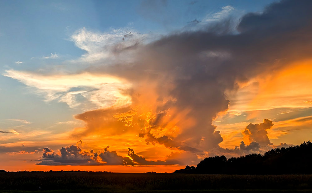
Pictured: Looking WNW from Highway 29 in Molino toward the remnants of an afternoon thundercloud near Barrineau Park on Friday. NorthEscambia.com, click to enlarge..
High Around 90, Scattered Showers Through The Weekend
August 7, 2026
Here is your official North Escambia area forecast:
Friday: A 30 percent chance of showers and thunderstorms, mainly after 1pm. Mostly sunny, with a high near 90. Calm wind becoming south around 5 mph in the afternoon.
Friday Night: Partly cloudy, with a low around 72. South wind around 5 mph becoming calm.
Saturday: A 40 percent chance of showers and thunderstorms after 1pm. Mostly sunny, with a high near 90. Calm wind becoming southeast around 5 mph in the afternoon.
Saturday Night: Mostly clear, with a low around 73. Calm wind.
Sunday: A 40 percent chance of showers and thunderstorms after 1pm. Mostly sunny, with a high near 91. Calm wind becoming south around 5 mph in the afternoon.
Sunday Night: Partly cloudy, with a low around 73. Calm wind.
Monday: A 50 percent chance of showers and thunderstorms after 1pm. Mostly sunny, with a high near 90. Calm wind becoming southwest around 5 mph in the afternoon.
Monday Night: Partly cloudy, with a low around 73. Calm wind.
Tuesday: A 50 percent chance of showers and thunderstorms after 1pm. Mostly sunny, with a high near 89.
Tuesday Night: Partly cloudy, with a low around 73.
Wednesday: A 50 percent chance of showers and thunderstorms. Mostly sunny, with a high near 90.
Wednesday Night: Partly cloudy, with a low around 73.
Thursday: A 40 percent chance of showers and thunderstorms. Mostly sunny, with a high near 91.
Annual Tate Aggies Crimson And Gray Game, Fish Fry Are Tonight
August 7, 2026
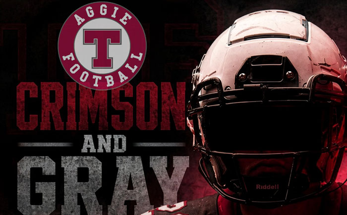
The Tate Aggies Crimson and Gray game is set for 6:30 p.m. Friday at Pete Gindl Stadium.
Game tickets and fish plates can be purchased on GoFan. Fish plates will also be available at the Aggie Shack.
This is an annual fundraiser for the Tate Aggies Quarterback Club to help support the football program.
Up next, the Aggies will host the Pine Forest Eagles in a jamboree game on Friday, August 14 at 7 p.m. The regular season begins August 21 as Tate hosts Marianna.
Typical Summertime Weather Pattern Returns
August 6, 2026
Isolated to scattered showers and thunderstorms will be possible each afternoon through the rest of the week as heat indices trent upward, reaching up to 107 degrees.
Here is your official North Escambia area forecast:
Thursday: A 30 percent chance of showers and thunderstorms, mainly after 1pm. Mostly sunny, with a high near 90. Calm wind becoming south around 5 mph in the afternoon.
Thursday Night: Partly cloudy, with a low around 72. South wind around 5 mph becoming calm.
Friday: A 40 percent chance of showers and thunderstorms after 1pm. Mostly sunny, with a high near 90. Calm wind becoming east around 5 mph in the afternoon.
Friday Night: Mostly clear, with a low around 73. Calm wind.
Saturday: A 20 percent chance of showers and thunderstorms after 1pm. Sunny, with a high near 91. Calm wind becoming northeast around 5 mph.
Saturday Night: Partly cloudy, with a low around 74. Calm wind.
Sunday: A 40 percent chance of showers and thunderstorms, mainly after 1pm. Mostly sunny, with a high near 90. Calm wind becoming southeast around 5 mph in the afternoon.
Sunday Night: Partly cloudy, with a low around 74. Calm wind.
Monday: Showers and thunderstorms likely, mainly after 1pm. Mostly sunny, with a high near 90. Chance of precipitation is 60%.
Monday Night: Partly cloudy, with a low around 74.
Tuesday: A 40 percent chance of showers and thunderstorms. Mostly sunny, with a high near 91.
Tuesday Night: Partly cloudy, with a low around 74.
Wednesday: A 40 percent chance of showers and thunderstorms. Mostly sunny, with a high near 91.