Sunny And Cold, Freeze Tonight
December 9, 2017
Here is your official North Escambia area forecast:
Saturday: Sunny, with a high near 48. Wind chill values between 20 and 30 early. Northwest wind 5 to 15 mph.
Saturday Night: Clear, with a low around 27. West wind around 5 mph becoming calm in the evening.
Sunday: Sunny, with a high near 55. Light northwest wind increasing to 5 to 10 mph in the morning.
Sunday Night: Clear, with a low around 30. Calm wind.
Monday: Sunny, with a high near 62. Light southwest wind increasing to 5 to 10 mph in the morning.
Monday Night: Mostly clear, with a low around 38. South wind around 5 mph becoming west after midnight.
Tuesday: Sunny, with a high near 60. Northwest wind 5 to 10 mph.
Tuesday Night: Clear, with a low around 31. Northwest wind around 5 mph.
Wednesday: Sunny, with a high near 55.
Wednesday Night: Mostly clear, with a low around 33.
Thursday: Sunny, with a high near 61.
Thursday Night: Partly cloudy, with a low around 39.
Friday: Sunny, with a high near 63.
Christmas Parades Set For This Weekend; PCI, Brewton Postpone Parades
December 9, 2017
Several Christmas parades are planned in the North Escambia area this weekend, while the Poarch Creek Indians and the Brewton Chamber of Commerce have rescheduled their parades.
Poarch of Creek Indians Christmas Parade
The Poarch Band of Creek Indians 2017 Annual Christmas Parade “Traditions of Christmas” has been postponed until Tuesday, December 19 at 5:30 p.m.. For more information, call (251) 368-9136 ext. 2107.
Brewton Christmas Parade
The Greater Brewton Area Chamber of Commerce Christmas Parade has been rescheduled to Saturday at 6 p.m. The parade will line-up in East Brewton on Shoffner Street. It will come down Forrest Avenue over the bridge to Mildred Street. The parade will turn right at the light as it crosses the tracks and then will turn left onto Belleville Avenue. The Brewton/East Brewton Baptist Churches will have a concert after the parade at the mural where the Choo Choo Market is located. Lots of floats, bands and of course Mrs. Claus and the big guy himself will be riding in the parade.
Atmore Twilight Christmas Parade
The 2017 Atmore Twilight Christmas Parade will be Saturday , December 9 at 5:30 p.m. The two-mile long parade will travel from City Hall down Main Street to Lindberg Avenue. For more information: (251) 368-3305.
Jay Christmas Parade and Celebration on Commerce Street
The Jay Christmas Parade will leave the city park at 10 a.m. on Saturday, December 9. Christmas booths will be open 8 a.m. until 2p.m. on Commerce Street. Visits and pictures with Santa and Mrs. Claus immediately after the parade. More info: (850) 675-4556
Pensacola Christmas Parade
The Pensacola Christmas Parade will begin at 5:15 p.m. on Saturday, December 9 with nearly 90 entries and eight bands from Escambia County and beyond, and the Blue Angels. Spring Street to Palafox north to Wright, back south on Palafox to Government.
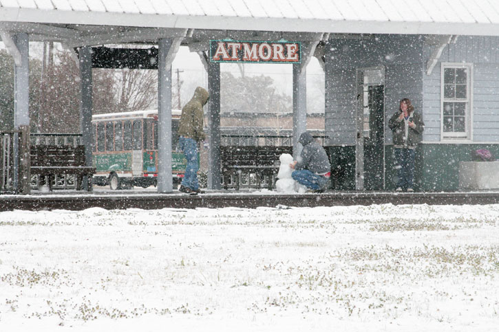
Pictured top: Main Street on a cold, wet Thursday afternoon in downtown Atmore, AL. The annual Twilight Christmas Parade will be at 5:30 p.m. Saturday on Main Street in Atmore. NorthEscambia.com photo, click to enlarge.
Let It Snow! Winter Weather Advisory Issued
December 8, 2017
A winter weather advisory has been issued for the North Escambia area. Snow is in the forecast tonight, with up to 1 inch accumulation. Ice may also form on bridges and overpasses, making driving dangerous. There is also a freeze warning in effect for tonight.
Send your snow photos to news@northescambia.com and we might use them in our coverage.
Here is your official North Escambia area forecast:
Saturday: Sunny, with a high near 47. Wind chill values between 25 and 35 early. Northwest wind 5 to 15 mph.
Saturday Night: Clear, with a low around 28. West wind around 5 mph becoming calm after midnight.
Sunday: Sunny, with a high near 51. Calm wind becoming northwest around 5 mph.
Sunday Night: Clear, with a low around 31. Calm wind becoming west around 5 mph.
Monday: Sunny, with a high near 60. Calm wind becoming southwest around 5 mph in the morning.
Monday Night: Mostly clear, with a low around 40. Southwest wind around 5 mph becoming west after midnight.
Tuesday: Sunny, with a high near 58. Northwest wind 5 to 10 mph.
Tuesday Night: Clear, with a low around 33.
Wednesday: Sunny, with a high near 56.
Wednesday Night: Mostly clear, with a low around 37.
Thursday: Sunny, with a high near 63.
Thursday Night: Partly cloudy, with a low around 42.
Friday: Mostly sunny, with a high near 61.
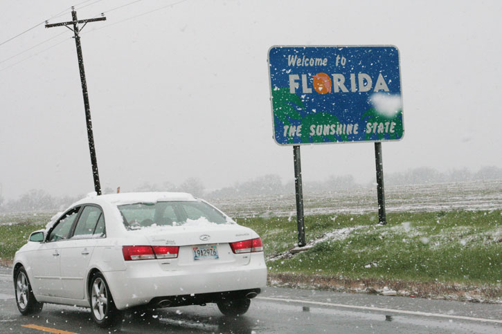
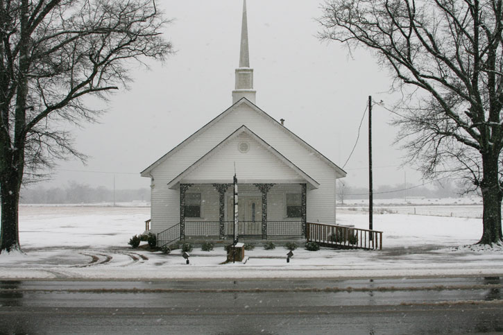
Pictured: A flashback to a snowy day in February 2010 showing (top) a rare Florida snowfall, heavier snow in Atmore (below) and several inches around Highway 21 and I-65 (bottom). NorthEscambia.com photos, click to enlarge.

A Really Cold Rain Today, And Then Maybe Some Snow?
December 7, 2017
Here is your official North Escambia area forecast:
Tonight: Rain. Low around 35. North wind 10 to 15 mph. Chance of precipitation is 90%. New precipitation amounts between a half and three quarters of an inch possible.
Friday: Rain. High near 39. North wind 10 to 15 mph, with gusts as high as 20 mph. Chance of precipitation is 90%. New precipitation amounts between a quarter and half of an inch possible.
Friday Night: Rain and snow likely before midnight, then a slight chance of snow between midnight and 3am. Cloudy, then gradually becoming partly cloudy, with a low around 28. North wind 5 to 10 mph. Chance of precipitation is 60%.
Saturday: Sunny, with a high near 49. West wind 5 to 15 mph.
Saturday Night: Clear, with a low around 28. West wind around 5 mph becoming north after midnight.
Sunday: Sunny, with a high near 51. Northwest wind 5 to 10 mph.
Sunday Night: Clear, with a low around 29. Northwest wind around 5 mph becoming calm after midnight.
Monday: Sunny, with a high near 60. Light west wind becoming southwest 5 to 10 mph in the morning.
Monday Night: Mostly clear, with a low around 39.
Tuesday: Sunny, with a high near 57.
Tuesday Night: Mostly clear, with a low around 34.
Wednesday: Sunny, with a high near 59.
Wednesday Night: Mostly clear, with a low around 37.
Thursday: Sunny, with a high near 62.
Hello Winter Weather! Falling Temps And A Cold Rain
December 6, 2017
Here is your official North Escambia area forecast:
Tonight: Rain likely, mainly after midnight. Cloudy, with a low around 39. North wind around 10 mph. Chance of precipitation is 60%. New precipitation amounts between a tenth and quarter of an inch possible.
Thursday: Rain. High near 43. North wind around 10 mph. Chance of precipitation is 100%. New precipitation amounts between a quarter and half of an inch possible.
Thursday Night: Rain. Low around 36. North wind 5 to 10 mph. Chance of precipitation is 80%.
Friday: Rain. High near 42. North wind 5 to 10 mph. Chance of precipitation is 80%.
Friday Night: A chance of rain and snow before 9pm. Mostly cloudy, with a low around 28. Northwest wind around 5 mph. Chance of precipitation is 30%.
Saturday: Sunny, with a high near 52. West wind 5 to 10 mph.
Saturday Night: Clear, with a low around 30. West wind around 5 mph becoming north after midnight.
Sunday: Sunny, with a high near 53. North wind around 5 mph.
Sunday Night: Clear, with a low around 30.
Monday: Sunny, with a high near 59.
Monday Night: Mostly clear, with a low around 40.
Tuesday: Mostly sunny, with a high near 59.
Tuesday Night: Mostly clear, with a low around 33.
Wednesday: Sunny, with a high near 56.
Showers And Thunderstorms; Turning Colder
December 5, 2017
Here is your official North Escambia area forecast:
Tonight: Showers and possibly a thunderstorm before 9pm, then a chance of showers between 9pm and midnight, then a slight chance of rain after midnight. Low around 48. Southwest wind 5 to 10 mph becoming north after midnight. Chance of precipitation is 80%. New precipitation amounts between a quarter and half of an inch possible.
Wednesday: Rain likely, mainly after noon. Cloudy, with a temperature falling to around 44 by 5pm. North wind around 10 mph. Chance of precipitation is 60%. New precipitation amounts between a tenth and quarter of an inch possible.
Wednesday Night: Rain likely, mainly before midnight. Cloudy, with a low around 40. North wind around 10 mph. Chance of precipitation is 60%.
Thursday: Rain likely, mainly after noon. Cloudy, with a high near 48. North wind around 10 mph. Chance of precipitation is 60%.
Thursday Night: Rain likely, mainly before midnight. Cloudy, with a low around 36. North wind around 5 mph. Chance of precipitation is 60%.
Friday: Rain likely, mainly before noon. Mostly cloudy, with a high near 43. North wind 5 to 10 mph. Chance of precipitation is 60%.
Friday Night: Partly cloudy, with a low around 28. Northwest wind around 5 mph.
Saturday: Sunny, with a high near 54. West wind 5 to 10 mph.
Saturday Night: Clear, with a low around 31.
Sunday: Sunny, with a high near 55.
Sunday Night: Clear, with a low around 34.
Monday: Sunny, with a high near 62.
Monday Night: Mostly clear, with a low around 41.
‘A Christmas Carol’ On Stage Tonight At The Molino Branch Library
December 4, 2017
The Hampstead Stage Company will present a heartwarming rendition of Charles Dickens’ “A Christmas Carol” tonight at 6:00 at the Molino Branch Library. Admission is free.
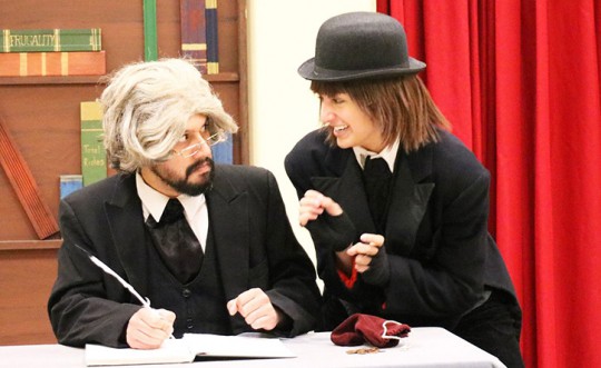
Pictured: “A Christmas Carol”presented by the Hampstead Stage Company Friday at the Tyron Branch Library. Photos for NorthEscambia.com, click to enlarge.
Sunny And Warm Today, Rain Midweek And A Big Chill Later
December 4, 2017
Here is your official North Escambia area forecast:
Monday: Partly sunny, with a high near 75. Southeast wind around 5 mph.
Monday Night: A 20 percent chance of showers after midnight. Areas of fog after midnight. Otherwise, mostly cloudy, with a low around 61. Southeast wind around 5 mph.
Tuesday: A slight chance of showers, then showers likely and possibly a thunderstorm after noon. Areas of fog before 9am. Otherwise, mostly cloudy, with a high near 76. Southeast wind 5 to 10 mph becoming southwest in the afternoon. Chance of precipitation is 60%.
Tuesday Night: Showers and possibly a thunderstorm. Low around 47. Southwest wind 5 to 10 mph becoming north after midnight. Chance of precipitation is 90%.
Wednesday: A 20 percent chance of showers. Partly sunny, with a high near 51. North wind around 10 mph.
Wednesday Night: A 50 percent chance of showers. Mostly cloudy, with a low around 38. North wind around 10 mph.
Thursday: A 50 percent chance of showers. Cloudy, with a high near 51. North wind 5 to 10 mph.
Thursday Night: A 20 percent chance of showers. Mostly cloudy, with a low around 34. Northwest wind around 5 mph.
Friday: Sunny, with a high near 57.
Friday Night: Mostly clear, with a low around 35.
Saturday: Sunny, with a high near 58.
Saturday Night: Mostly clear, with a low around 34.
Sunday: Sunny, with a high near 58.
Sunny And Warm To Start The Week, Maybe A Light Freeze By Week’s End
December 3, 2017
Here is your official North Escambia area forecast:
Sunday: Partly sunny, with a high near 71. Calm wind becoming northeast around 5 mph.
Sunday Night: Mostly cloudy, with a low around 53. Calm wind becoming east around 5 mph.
Monday: Partly sunny, with a high near 76. Light east wind becoming southeast 5 to 10 mph in the morning.
Monday Night: A 20 percent chance of showers. Mostly cloudy, with a low around 62. Southeast wind around 5 mph.
Tuesday: Showers likely and possibly a thunderstorm. Mostly cloudy, with a high near 75. South wind 5 to 15 mph. Chance of precipitation is 60%.
Tuesday Night: Rain. Low around 47. South wind 5 to 10 mph becoming north after midnight. Chance of precipitatTuesday Night: Rain. Low around 47. South wind 5 to 10 mph becoming north after midnight. Chance of precipitation is 80%.
Wednesday: A 50 percent chance of rain. Mostly cloudy, with a high near 55. North wind 5 to 10 mph.
Wednesday Night: A 20 percent chance of rain. Mostly cloudy, with a low around 36. North wind around 5 mph.
Thursday: A 20 percent chance of rain. Partly sunny, with a high near 55.
Thursday Night: A 20 percent chance of rain. Partly cloudy, with a low around 33.
Friday: Sunny, with a high near 55.
Friday Night: Mostly clear, with a low around 32.
Saturday: Sunny, with a high near 56.
Warm Pattern Continues, Rain By Tuesday
December 2, 2017
Here is your official North Escambia area forecast:
Saturday: Becoming mostly sunny, with a high near 73. North wind around 5 mph becoming calm.
Saturday Night: Partly cloudy, with a low around 51. Calm wind.
Sunday: Mostly sunny, with a high near 71. Calm wind becoming north around 5 mph.
Sunday Night: Partly cloudy, with a low around 51. Calm wind becoming east around 5 mph.
Monday: Mostly sunny, with a high near 74. Calm wind becoming southeast around 5 mph in the morning.
Monday Night: Mostly cloudy, with a low around 61. Southeast wind around 5 mph.
Tuesday: A chance of showers and thunderstorms, then showers likely and possibly a thunderstorm after noon. Mostly cloudy, with a high near 75. South wind 5 to 10 mph. Chance of precipitation is 60%.
Tuesday Night: Showers likely and possibly a thunderstorm. Mostly cloudy, with a low around 48. South wind 5 to 10 mph becoming north after midnight. Chance of precipitation is 70%.
Wednesday: A 50 percent chance of showers. Mostly cloudy, with a high near 58.
Wednesday Night: Mostly cloudy, with a low around 38.
Thursday: Mostly sunny, with a high near 56.
Thursday Night: Partly cloudy, with a low around 33.
Friday: Sunny, with a high near 55.


