

Latest Headlines
- Flomaton Man Killed In Monday Morning Crash Near Century
- Qualifying Week For Three Century Town Council Seats Begins Monday
- Molino Tax Collector Office Wins Statewide Donate Life Photo Contest Award
- Even With Over A Foot Of Rain Last Month, We’re Still In A Drought
- ECSO: Hallucinating Man Fired Shots Inside His Beulah Apartment, Bullets Pierced Adjacent Unit
- Want To Be A Firefighter? ECFR Physical Abilities Test Is June 15
- Here Are This Week’s Road Constructions Spots To Watch
- Is Your Church Having VBS?
- Register Now For Tate Cheerleaders’ Lil Aggies Summer Camp
- Ignoffo Ignites Offense In 5-4 Blue Wahoos Win

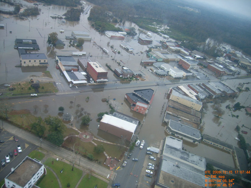
Aerial Photos: Flooding In Flomaton, Brewton
December 16, 2009

Aerial photos show the extent of the flooding in both Flomaton and Brewton. For more aerial photos from both Flomaton and Brewton, click here. Pictured above: Flooding in Flomaton. Pictured below: Flooding in Brewton. Submitted photos by the Alabama Forestry Commission for NorthEscambia.com, click to enlarge.
Comments
One Response to “Aerial Photos: Flooding In Flomaton, Brewton”
Ah, that new park and walk way brewton built with money that could of been used on the poor roads that helped flood downtown, and man holes everywhere is 100% down the drain nearly. I guess our taxes will just go up more most likely.